Kings Peak in Evanston, Utah is a beast of a mountain! It’s not only the tallest mountain in Utah, but also the state’s highest point. The summit of Kings Peak sits at 13,528 feet – it may not be Mt. Everest, but it’s a spectacular climb right in our backyard.
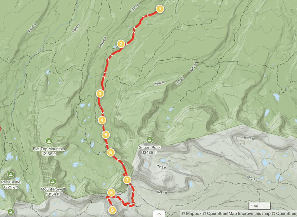
I climbed this mountain a couple of summers ago with friends and we took two days to complete the hike. We met in Salt Lake City at 3:30am and made the three-hour drive to Henry’s Fork trailhead. Even though it’s in Utah, the quickest way to reach the trailhead from Salt Lake is driving through Wyoming.
From Mountain View, take Wyoming State Highway 414 to Lonetree. Once reaching Lonetree, turn onto County Road 290. You’ll see signs for Henry’s Fork Campground–follow those signs. For reference, the campground is 29.2 miles from Mountain View. From the campground, you’ll take County Road 224 all the way to the end to reach Henry’s Fork Trailhead.
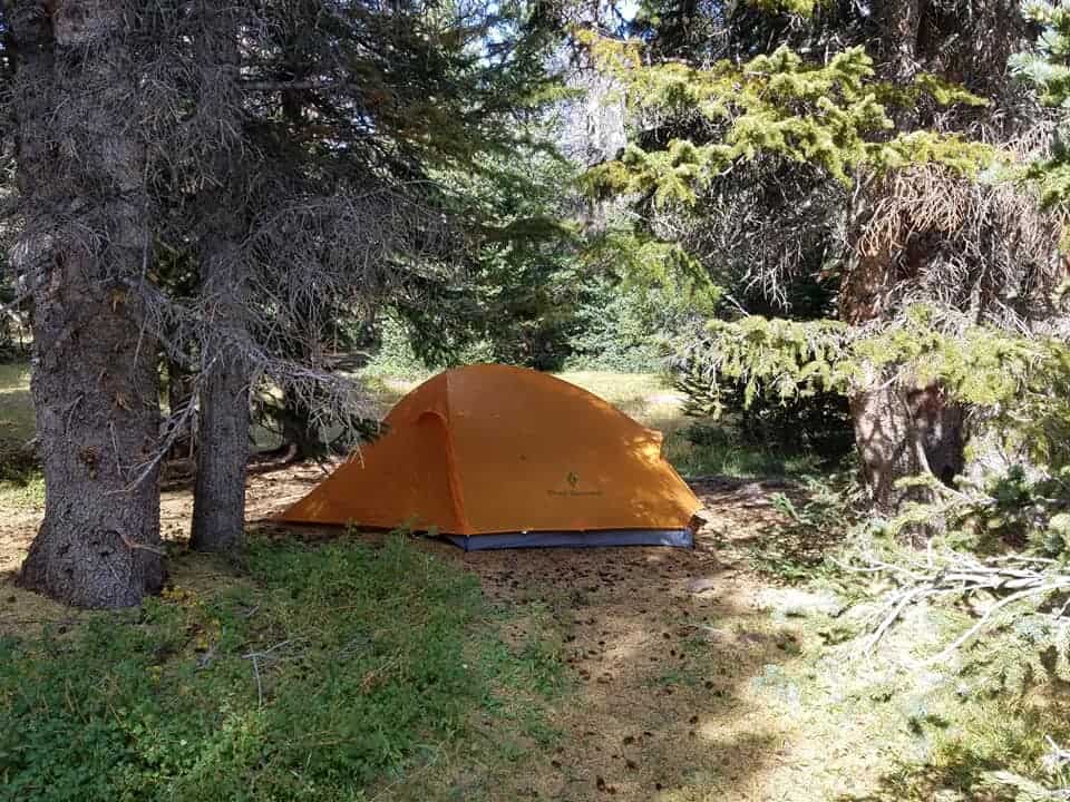
There are routes in nearly every direction that lead to the summit, but the most popular (and the route we took) starts at Henry’s Fork trailhead. The trailhead is in Henry’s Fork Campground and many people choose to camp here the night before starting the hike. No reservations required and camping is free. Be prepared for a chilly night even in the summer, though. The campground sits at 9,420 feet up in the Uinta mountains.
From the trailhead, you’ll walk along a sort of dried riverbed of a trail. This makes for a pleasant, gradual (but sometimes muddy) ascent for the first 3 miles. Around this point, you’ll pass Alligator Lake campground, which is the most popular camp spot for backpackers.
From July to September, camping at Alligator Lake can get crowded. My crew ended up finding a small pond in the vicinity of Alligator Lake but on the opposite side of the trail. There were lots of nice camp spots nestled throughout the woods in this area, so keep that in mind if Alligator Lake is crowded.
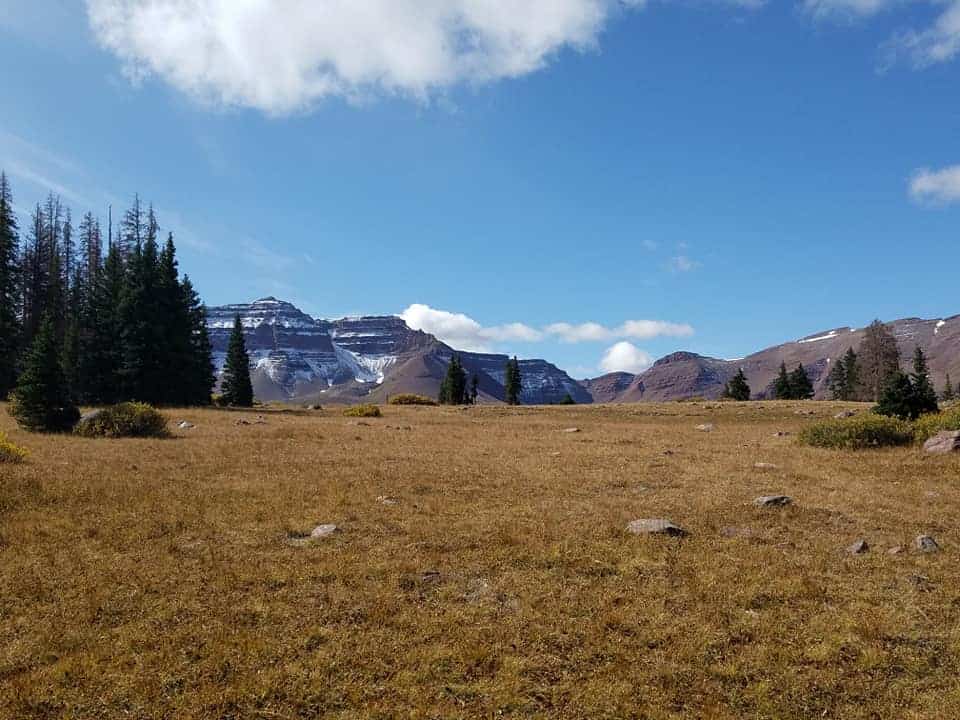
After passing Alligator Lake, you’ll continue another ~2.5 miles until you reach Elkhorn Crossing. This is where Henry’s Fork Trail and North Slope Trail intersect. If you stay south on the most direct route (like my crew did), you’ll pass Dollar Lake, which is a popular break spot.
If you have the time and energy, you can opt to take the West Side Loop which is 1.6 miles longer than the direct route. It will take you past Sawmill Lake, Bear Lake, Grass Lake, and Henry’s Fork Lake–and you’ll escape the crowd.
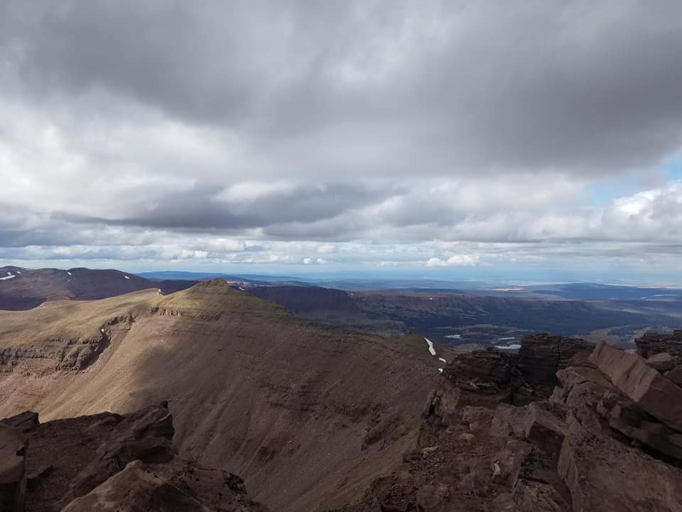
About 2 miles from Elkhorn Crossing (if you take the direct route), you’ll reach Gunsight Pass. The recommended route is to continue south through the pass and down into its valley. This sets you up for summiting between the east face of Kings Peak and the Highline Ridge’s south face.
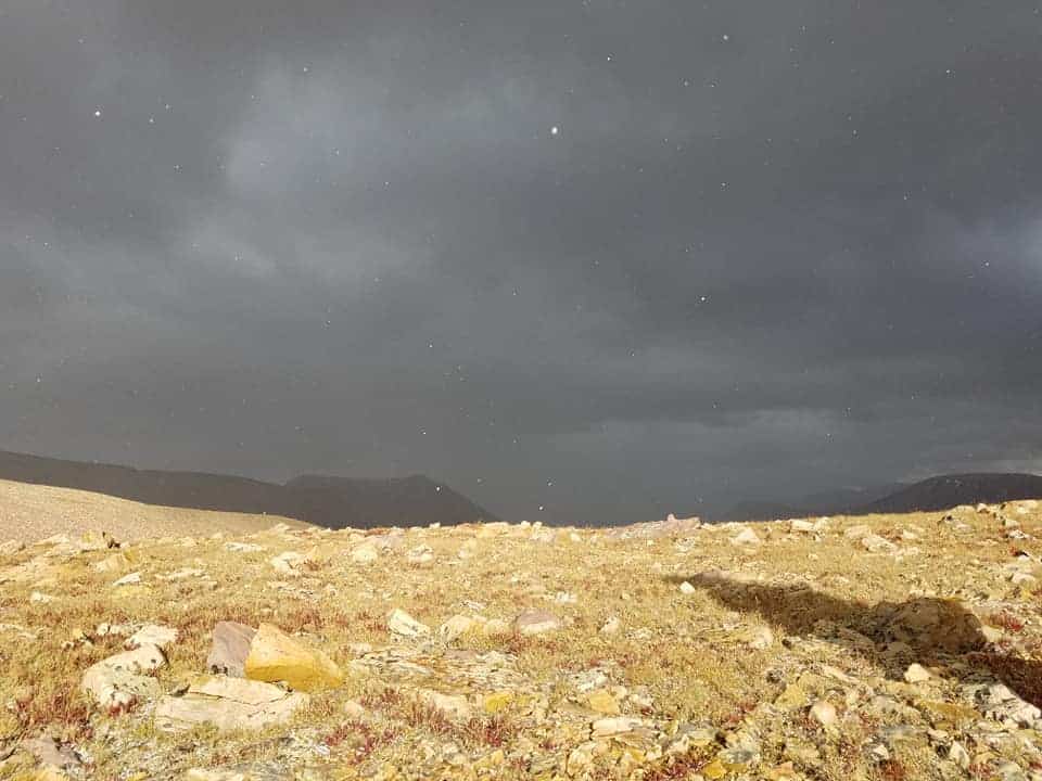
On our way down from the peak, it lightly snowed on us despite it being August. It was wild to see, as the sun still snuck through the clouds.
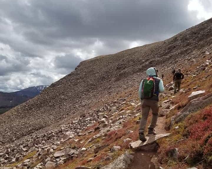
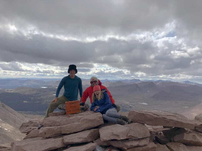
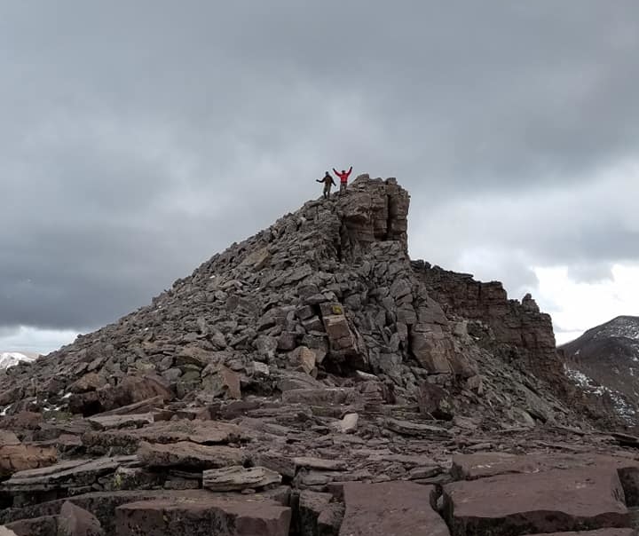
4.6 miles from Gunsight Pass, you’ll reach Kings Peak summit! Be ready for lots of boulder hopping and scrambling up rocks. It isn’t the sketchiest rock scrambling in Utah, but it took a lot out of me. But, oh so worth it.
It’s definitely possible to hike Kings Peak in a day–we ran into a young couple at the summit who did that. But you’re looking at the bare minimum of a 12-hour hiking day, which means every minute of daylight is extra precious. It’d make it a lot more stressful to stop and enjoy the scenery for me, too.
Most people hike Kings Peak in 2-3 days. My crew backpacked in 3 miles, hid our camping gear in nearby woods, then summited that same day. By the time we got back to our camping gear, it was dark out which made things trickier, but still worth it. We then packed up and hiked out the remaining 3 miles the next morning.
Altitude Sickness
After summiting and coming back through Gunsight Pass, I got mild altitude sickness. I felt dizzy, loopy, and needed to stop after taking a few steps every minute. Even though I’d eaten properly and drank lots of water, it was still a lot for my body. So be warned if you’re sensitive to this! Thankfully it went away after 30-60 minutes.
Water Supply
Bring more water than you think you’ll need, even if you have a water filter. At the trailhead, I dumped out a whole Camelbak of water because I learned my friend had a water filter with him. I figured we could use that to refill, so I brought half of my original water supply. Turns out, the water filter wasn’t working properly and the pond we planned to pull water from was partially frozen. We ended up boiling water that night to re-supply. Don’t do what I did!
Headlamps & Flashlights
Whether you plan on hiking Kings Peak in one day or three days, you’ll need a source of light. There’s barely enough sunlight to get you through this as a day hike, and headlamps will help prevent accidents or getting lost.
Warm Clothes
Unpredictable storms, summit winds and nighttime temps dropping below zero are why you need to pack very warm clothes. Even on a late August night, my crew were bundled up in hats, jackets, and goose-feather sleeping bags. It reached just above or at freezing temperature throughout the night. Earlier in the day at the summit, we watched it snow a bit. So, due to elevation, Kings Peak is never fully safe from the cold.
**********
You’re going to feel damn proud (and damn hungry) after completing this hike. With breathtaking views that really make you feel like you’re in the middle of nowhere, it’s an impressive feat. And even though this is the tallest point in Utah, it was easier on my body than hiking Mt. Nebo or Mt. Timpanogos. I loved that I was able to backpack in for three (fairly flat) miles then leave most of my gear for the summit. It made backpacking much more enjoyable.