Skip to content Skip to sidebar Skip to footer

Mt. Nebo Utah Hike & Camping Guide

Mt. Nebo, Utah is the tallest peak in the Wasatch mountain range and the seventh tallest peak in all of Utah. Mt. Nebo is part of the Nebo Loop scenic byway in Juab County. The scenic byway stretches for 38 miles, with one entrance point outside Payson, UT and the other outside Nephi, UT.  Although not a long hike, Mt Nebo Utah hike is very strenuous–but very rewarding.

hiking mount nebo snow

If you’re ready to take on one of the most challenging hikes in Utah, I guarantee you won’t regret it. With views ranging from grassy, green meadows to desolate rock ridgelines, Mt. Nebo has it all–and just under ten miles round-trip. 

Table of Contents

How tall is Mt. Nebo?

The peak of Mt. Nebo sits at 11,933 feet. It is the tallest point in all of Utah County. 

Photo by Alex Frost

How long does it take to hike Mt. Nebo?

About six to eight hours–my crew took about eight hours. According to AllTrails, the official mileage to the peak of Mt. Nebo is 9.3 miles round-trip. It’s an out-and-back trail with elevation gains of 3,589 feet. 

If you aren’t looking to climb all the way to the peak, a popular turn-around spot is at the North Peak, which is 5.3 miles out-and-back. No question that North Peak is still a very strenuous hike and only 750 feet lower than Mt. Nebo summit. However, you skip more of the sketchy rock scramble. There’s also the Bench Trail that has a different, but nearby trailhead.

saddle-mt-nebo

Mt Nebo Utah Hike Overview

Hands down, Mt. Nebo is the best hike I’ve ever done. Not only are the views amazing and I get the bragging rights of climbing the tallest peak in the Wasatch, but it’s also a quiet mountain. It gets far less traffic than its more popular counterpart, Mt. Timpanogos, despite it being just 200 feet taller than Timp. (That being said, Timp is still an amazing hike–check out my hiking guide on Mt. Timp). 

I hiked Nebo in late July and had the pleasure of seeing colorful flowers, lush green meadows, thick forest and rock scrambles that (literally) took my breath away (from the elevation!). The snow was almost completely melted in all pathway areas.

green meadow mt nebo utah

The first few miles of the hike are a steady incline through fields and forest, gaining roughly 1,400 feet in elevation. Then, in less than a mile, you climb 1,300 feet up rock ridges and you feel it. The views are expansive and although nerve-racking, the rock ridge didn’t feel life-threatening to me. 

side-ridge-mt-nebo

Most of the hike is on exposed terrain so it’s important to bring sun-protectant gear. Although the hike is only 9.3 miles roundtrip, it’s a very strenuous hike with one false summit.

How to Get to Mt. Nebo Trailhead

mt nebo near trailhead
Photo by Alex Frost

From Salt Lake City (North)

It’s about 1 hour and 45 minutes (~84 miles) from downtown Salt Lake City to Mt. Nebo trailhead. Follow these directions:

  • Drive south on I-15 for about 48 minutes (~56 miles)
  • Take Exit 250 in Payson
  • In 0.2 miles turn left onto 3200 W/Main St
  • In 0.8 miles turn left onto UT-198 E/E 100 N
  • In 0.5 miles turn right onto N 600 E
  • In 1.4 miles continue onto FR 015/Nebo Loop Rd
  • In 22.6 miles turn right onto FR 160
  • In 80 feet turn right to stay on FR 160

***The trailhead is down a short dirt road and ends in a dirt parking lot. Don’t be fooled by the first trailhead you see when turning onto FR 160–continue down a dirt road to the right.

From Nephi (South)

It’s about a 36 minute drive from downtown Nephi to Mt. Nebo trailhead. Follow these directions:

  • Head south on N Main St toward E 100 N
  • In 85 feet turn left at the 1st cross street onto UT-132 E/E 100 N
  • In 5.9 miles turn left onto FR 015/Nebo Loop Rd
  • In 13.4 miles turn left onto FR 160
  • In 80 feet turn right to stay on FR 160

***The trailhead is down a short dirt road and ends in a dirt parking lot. Don’t be fooled by the first trailhead you see when turning onto FR 160–continue down a dirt road to the right.

false summit mt nebo ut
Photo by Alex Frost

How to Prep for Hiking Mt. Nebo

  • Bring at least 3-4 liters of water (I also recommend an energy drink)
  • Bring protein-based snacks (nuts, beef jerky, Clif bars)
  • Hike in late summer to avoid snow (July and August)
  • Start in the morning (no later than 10am MT)
  • Wear hiking boots with ankle support
  • Bring hiking poles if your knees tend to bother you on hikes
  • Bring sunscreen, sunglasses and/or sunscreen
  • Pace yourself, because the last stretch is the most strenuous

Why is Nebo less popular than Timpanogos?

I believe Nebo gets less traffic than Timpanogos because Mt. Nebo is more isolated and requires a fairly long drive through a byway. The byway doesn’t have cell phone service. It’s nearly a two-hour drive from Salt Lake City. If you don’t do an early-morning drive, then you need to find a camp spot in the Nebo Loop area the night before. This, of course, adds more overhead than hiking Mt. Timpanogos which is closer to the city.

My Video Tour of Mt. Nebo, UT

Here’s a short video summary of the terrain you can expect on Mt. Nebo. The hike took us about seven hours.


Nebo Loop Scenic Byway Map

The Nebo Loop byway offers awesome sight-seeing and activities beyond just hiking Mt. Nebo. It’s a popular place for camping along the river, horse-back riding and mountain biking. 

You can even check out the “mini Bryce Canyon” of northern Utah, which is called Devil’s Kitchen. It’s a well-marked pull-off (with pit toilets and signs) that leads to unique red rock cliffs and formations. Take a very short walk down a paved sidewalk to check out this randomly-place site! 

There are no entrance fees to Nebo Scenic Loop, but many signs that ask visitors to clean up after themselves and be respectful to the trails. 

Can you camp near Mt. Nebo?

camping at nebo loop utah
Photo by Alex Frost

There are incredible camp spots along Nebo Loop with breathtaking views of Utah County and Salt Lake Valley. There are established campgrounds at each end of the loop, but you won’t have as epic views (or cell service). The higher in elevation you drive up, the more likely you will have cell phone service. 

camp-food-fire

Throughout the 38-mile loop you will see pull-off spots along the road. Some have fire pit rings or others may go deeper into the woods. Some are right on the side of the road. My crew found a great spot near the highest elevation point on the loop the night before our hike! We made homemade pizzas over the fire (and yes, I even made homemade dough for it). The ultimate power food for a big hike. 

How long does the Nebo Loop take?

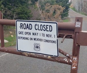
It takes about 1.5 hours to drive the 38-mile loop, if you’re simply looking for a scenic byway to drive through. The loop is closed in the winter because roads become hazardous from snow and ice. There are no exact dates of road closure but it’s safe to assume gates are open from May 1st until November 1st.

gate open mt nebo loop utah

If you’re in a campervan or slow-moving vehicle, be prepared to take even longer as the roads are winding and climb up to 9,000 feet in elevation. 

*******

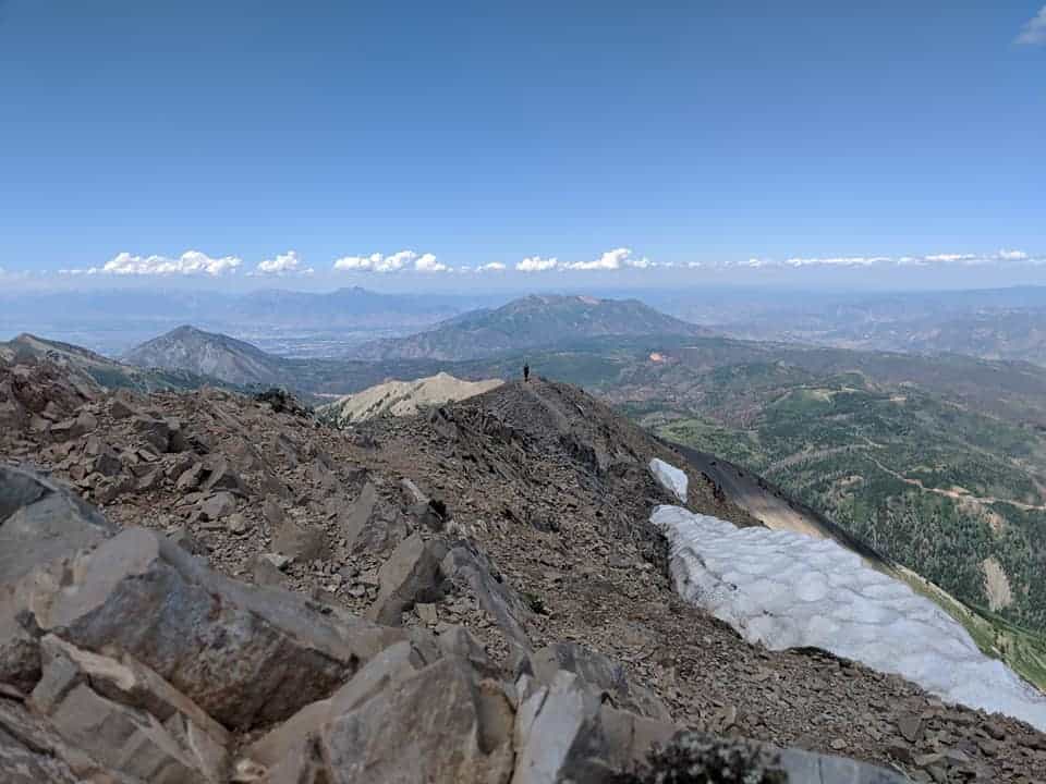
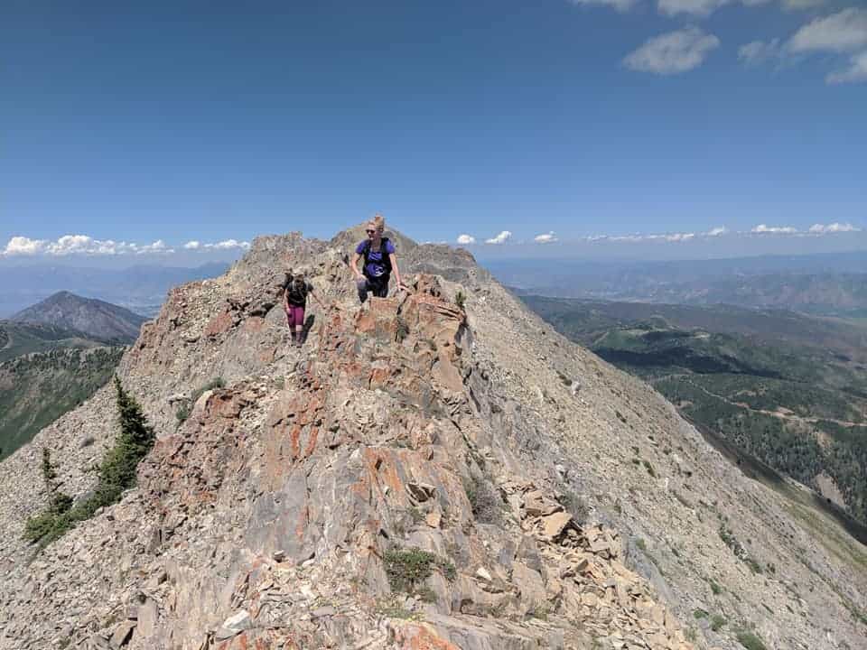
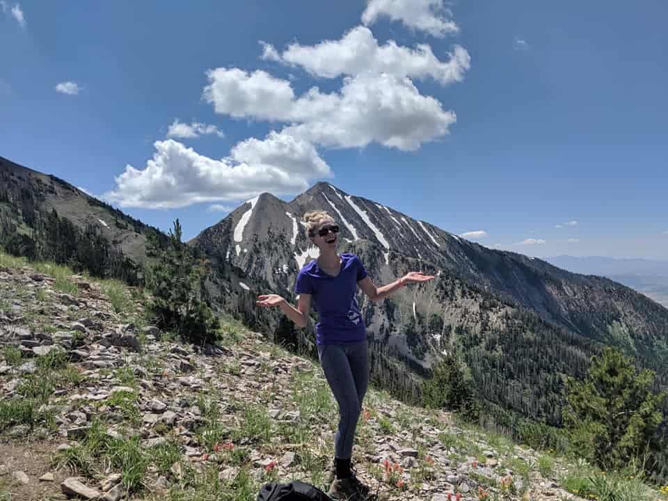
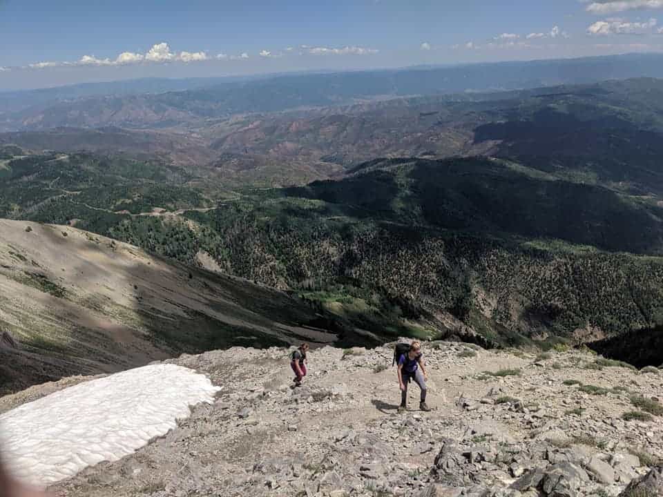
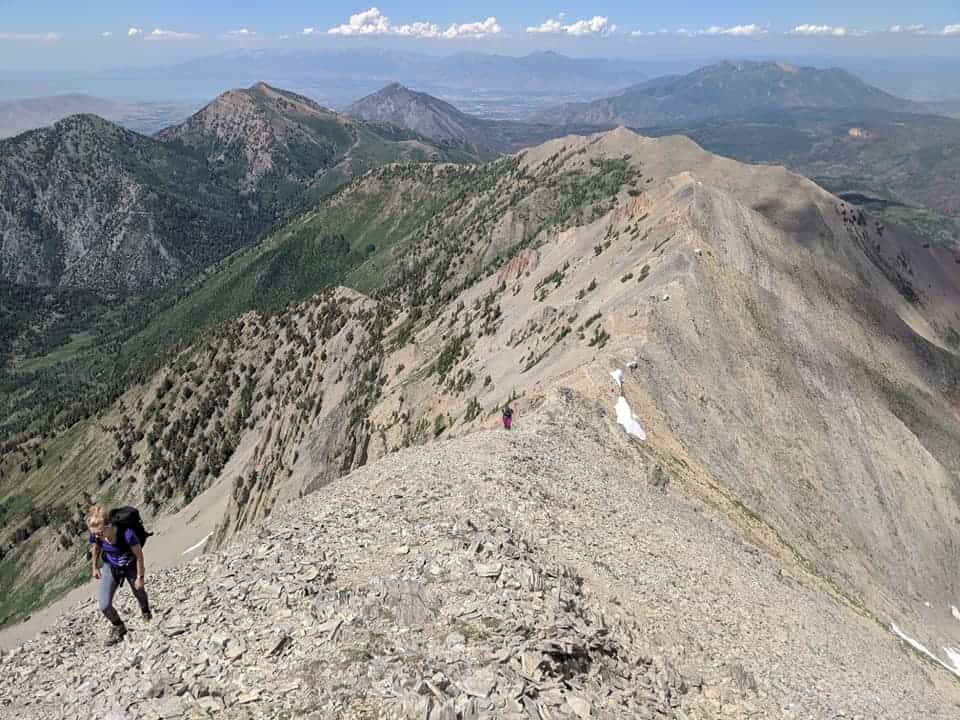
This hike will give you a run for your money but I promise the views are worth the grueling climb! If you’re looking for some easier hikes to take friends and family in the Salt Lake area, check out my favorite hikes in Millcreek Canyon!

If you found this article helpful, give it a save on Pinterest!

mt nebo hiking guide pinterest
how to hike mt nebo utah pinterest

Leave a Comment

Get Exclusive Tips & Stories

Sign up below to receive monthly email updates! Whether it's a hilarious short story or a special offer, I'll be including content that isn't on my website.

* indicates required